-
1、
Remote-sensing image characterizes terrestrial object by its spectrum and space identity.
遥感图像是通过光谱信息和空间信息表征地物的.
来源:互联网摘选 -
2、
A fast and convenient remote sensing method of geochemical exploration is proposed.
提出了快捷方便的遥感化探工作方法.
来源:互联网摘选 -
3、
Remote sensing image interpolation will be beneficial to solving those problems.
遥感图像插值对解决这些问题起到很好的作用.
来源:互联网摘选 -
4、
All materials have their characteristic spectral absorption peaks in remote sensing data.
各种物质在遥感数据中都有其特征的波谱吸收峰.
来源:网络文摘精选 -
5、
Microwave remote sensing is the most effective technique for soil moisture estimation.
微波遥感被认为是当前土壤水分监测中最有效的方法.
来源:互联网摘选 -
6、
Air temperature retrieval from remote sensing data based on thermodynamics.
根据热力学原理来自遥感资料的气温反演.
来源:互联网摘选 -
7、
The fractal texture can describe the space characteristic information of image correctly.
分形纹理能够准确刻画图像的空间特征信息,在遥感图像分类中作为空间特征信息的补充.
来源:互联网摘选 -
8、
Maximum likelihood classifier ( MLC ) is the most used and effective classification method.
最大似然 法分 是常规遥感图像最常用、最有效的分类方法.
来源:网络文摘精选 -
9、
Remote sensing of soil carbon storage is critical to understand climate chan.
首先,分析了利用遥感方法估算土壤碳储量的可行性.
来源:互联网摘选 -
10、
-
11、
Class B : areal geology survey; remote sensing geology exploration.
2901524乙级: 区域地质调查; 遥感地质勘查.
来源:互联网摘选 -
12、
It can translate data from maps or remote sensing instruments into images.
它可以把从地图或遥感设备中得到的数据转化成为图像。
来源:《柯林斯高阶英汉双解学习词典》 -
13、
FUSION OF MULTISPECTRAL REMOTE SENSING IMAGE AND HIGH RESOLUTION SPATIAL PANCHROMATIC IMAGE.
多光谱遥感影像与高分辨率全色影像融合研究.
来源:互联网摘选 -
14、
Both modeling and model-based inversion are important for quantitative remote sensing.
前向建模和基于模型的反演是定量遥感的两个主要方向.
来源:互联网摘选 -
15、
Improving classification accuracy is always the focus for remote sensing image classification.
提高遥感图像分类精度一直是受到普遍关注的焦点问题.
来源:互联网摘选 -
16、
Study on the Progress and Application of High Resolution Remote Sensing Technology
IKONOS等高分辨率遥感技术的发展与应用分析
来源:互联网摘选 -
17、
One of the most important technologies in EOS is hyperspectral remote sensing in 1990 s.
高光谱(hyperspectral)遥感是20世纪末地球观测系统中最重要的技术突破之一.
来源:互联网摘选 -
18、
The Research on Remote Sensing Image Segmentation Technology of Ulan Buh Desert in Inner Mongolia
内蒙古乌兰布和沙漠遥感影像图像分割技术研究
来源:互联网摘选 -
19、
传统方法已然不能满足高空间分辨率遥感影像的分类要求。
来源:互联网摘选 -
20、
Application of Remote Sensing Technology on Research of the Wetland in China
遥感技术在中国湿地研究中的应用
来源:互联网摘选
- 上一页
- 下一页
- 相关阅读
-

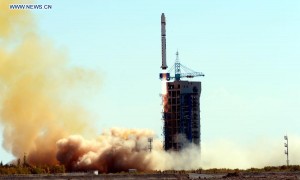
中国成功发射“资源一号”02C遥感卫星
简答网 · 双语新闻
-
中国发射“吉林一号”
简答网 · 双语新闻
-

手机平板购新补贴来了!产品售价的15% 每件不超500元
简答网 · 双语新闻
-

高考英语真题作文范文:申请信(2019年全国1卷)
简答网 · 高考英语
-

高考英语完形填空真题28(含答案解析)
简答网 · 高考英语
-

2025年6月四级作文范文带翻译5:祝贺信
简答网 · 四六级英语