-
1、
-
2、
A new approach for object identification based on the exhaustive method is proposed.
介绍了一种基于穷举法的高光谱遥感图像地物识别方法.
来源:互联网摘选 -
3、
-
4、
-
5、
Based on Fusion and GGM Change Detection Approach of Remote Sensing Images
基于融合和广义高斯模型的遥感影像变化检测
来源:互联网摘选 -
6、
Application of GVG Sampling System on the Forestry Remote Sensing Interpretation
GVG采样系统在林业遥感解译中的应用初探
来源:互联网摘选 -
7、
根据机载扫描仪的特点和遥感用户的要求,精心研制了在脱机状态下运行的CCT格式器。
来源:互联网摘选 -
8、
海洋初级生产力是基于海洋叶绿素a进行计算的,主要为叶绿素光合作用速率与遥感得到的叶绿素浓度在真光层的积分。
来源:互联网摘选 -
9、
通过3种主要的遥感过程模型(CASA、BIOME-BGC和BEPS模型)进行阐述和分析,探讨了这几种模型的优势和主要存在的问题。
来源:互联网摘选 -
10、
本文在Biome-BGC模型和BEPS模型基础上,构建了应用遥感数据的陆地净生态系统生产力模型(NEPARS),并分别以我国东北地区和全国为例,进行了模拟研究;
来源:互联网摘选 -
11、
图像数据融合技术和混合像元分解技术是林业遥感中颇具发展潜力的两个领域,有着广阔的应用前景。
来源:互联网摘选 -
12、
Comparative Study on Different Classification Accuracies for Hyperspectral Remote Sensing Images
高光谱遥感图像分类精度对比研究
来源:互联网摘选 -
13、
Design of a ZBT SRAM Controller for a High Speed Remote Sensing Image Compression System
高速遥感图像压缩系统ZBT SRAM控制器的设计
来源:互联网摘选 -
14、
Study on Semi-automatic Building Extraction from VHR Remotely Sensed Imagery
高分辨率遥感影像建筑物半自动提取方法研究
来源:互联网摘选 -
15、
基于决策树分类算法在遥感影像分类方面的深厚潜力,探讨了3种不同的决策树算法(UDT、MDT和HDT)。
来源:互联网摘选 -
16、
-
17、
利用1993年JERS-1OVN及1999年LANDSAT-7ETM+遥感资料,并结合实地调查,研究了新疆且末绿洲土地利用变化(LUCC)及其驱动力。
来源:互联网摘选 -
18、
Remote sensing monitoring of land desertification in the agriculture and graziery mixed area
农牧交错带土地沙化遥感监测
来源:互联网摘选 -
19、
-
20、
Study on the Quantizing Method of Regional Water Resources Dynamic Change by Remote Sensing
区域水资源动态变化遥感定量测算方法研究
来源:互联网摘选
- 相关阅读
-

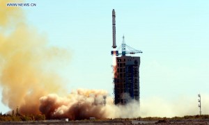
中国成功发射“资源一号”02C遥感卫星
简答网 · 双语新闻
-
中国发射“吉林一号”
简答网 · 双语新闻
-

手机平板购新补贴来了!产品售价的15% 每件不超500元
简答网 · 双语新闻
-

高考英语真题作文范文:申请信(2019年全国1卷)
简答网 · 高考英语
-

高考英语完形填空真题28(含答案解析)
简答网 · 高考英语
-

2025年6月四级作文范文带翻译5:祝贺信
简答网 · 四六级英语